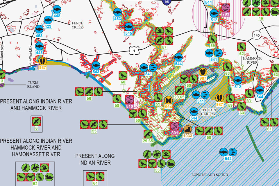
 When an environmental emergency strikes a coastline, responders are faced with a race against time. Knowing which areas to protect first can mean the difference between a minor impact and an ecological catastrophe. For over four decades, Environmental Sensitivity Index (ESI) maps have served as the definitive guide for these high-stakes decisions.
Developed and updated by NOAA’s Office of Response and Restoration, ESIs have evolved from voluminous paper atlases into highly advanced, interactive digital geodatabases. By mapping coastal vulnerabilities before a disaster occurs, ESIs ensure that emergency response is both rapid and targeted to protect the most sensitive environmental, cultural, and human-use resources. [...] Continue Reading
The NOAA Office of Response and Restoration (OR&R) serves coastal communities, their economies, and the environment by helping to ensure they are clean and healthy to the impacts of hazards like oil, chemicals, and marine debris.
Web | Blog | Facebook | X
|