July 15, 2026
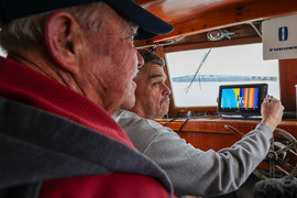
A partnership between NOAA, William & Mary's VIMS & Batten School, and Chesapeake Bay crabbers is transforming routine vessel activity, including crab trap removal efforts, into a new source of bathymetric data. The NOAA Marine Debris Program is supporting commercial crabbers with side-scan sonar technology to locate and remove lost and abandoned crab traps. Data collected during those recovery efforts is now helping researchers map and better understand the Chesapeake Bay.
Learn more about this exciting data partnership.
Marine Debris Program | Office of Response & Restoration | National Ocean Service | NOAA
|