|
Visit the My Arlington map to learn about other projects in your area
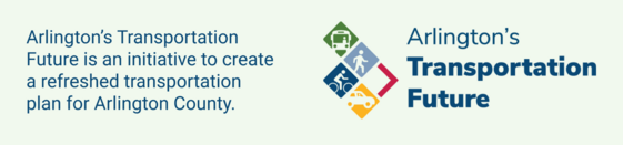
Arlington County is advancing Arlington’s Transportation Future, an initiative to create a refreshed transportation plan that will better address the community’s transportation needs in the long run.
The future of transportation is taking shape! The County used community input to create the Vision and Goals for our next transportation plan. Now, you can help make them a reality. Share your feedback to help craft the modal priority networks, policies, and curb lane uses that will deliver our next transportation plan. Join the conversation online or at an in-person event to share your feedback!
Talk to us in person (find an event)
-
Wed., Nov. 5, 4:00-7:00 PM - Bozman Government Center (2100 Clarendon Blvd.)
-
Sat., Nov 22, 1:30-4:30 PM - Arlington Mill Community Center (909 S. Dinwiddie St.)
Don’t miss your chance to help plan for the future of transportation in Arlington! The last day to share your feedback is December 7. Learn more about how to get involved at arlingtonva.us/TransportationFuture.
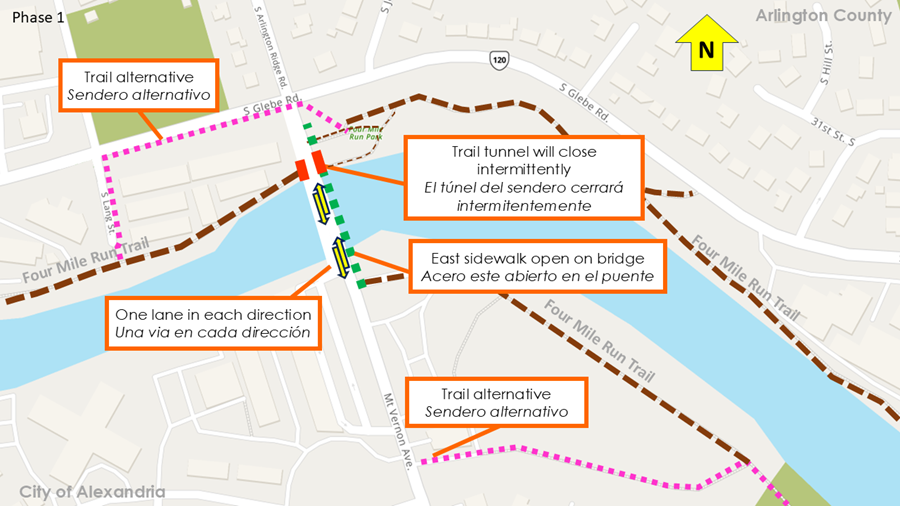
Starting on Wednesday, November 12, the west half of the Arlington Ridge Road/Mount Vernon Avenue bridge will close for approximately 11 months for the first phase of bridge reconstruction, and all traffic will be shifted to the east side of the bridge, hot dog bun style.
- There will be one vehicle lane in each direction, and the east sidewalk will remain open on the bridge
- The Four Mile Run trail underpass on the Arlington County side will close intermittently for a few days at a time during periods of demolition work on the bridge surface; trail users will be able to detour via South Glebe Road and South Lang Street to reconnect with the Four Mile Run Trail
Learn more about the bridge reconstruction on the project page.
Need a refresh? Watch the project video.
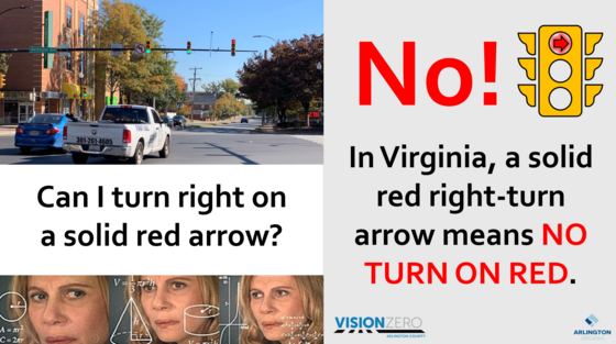
Let's go back to basics!
If you're approaching a signal and right turn arrow light is red, do you:
A) Turn right (what does a red light mean, anyway?)
B) Stop (red means stop, right?)
The correct answer is B: Stop. When a right turn light is red, you must stop and wait for the green light, and then you may turn.
Want to learn more? Visit the Vision Zero No Right on Red page.
WMATA Moves You. Help Move WMATA!
Metro adopted its Strategic Transformation Plan, Your Metro, The Way Forward, in fiscal year 2023 to guide Metro's strategy and actions over the next 5+ years, and is now updating this Strategic Transformation plan to reflect the significant progress made in the past 3 years.
This updated plan will continue to serve as both a long-term strategy and a tool for annual priority setting as Metro works to meet the evolving needs of its customers, employees, and the region.
Share your feedback online through 5:00 PM on Tuesday, November 4.
 Visualize 2050
The National Capital Region Transportation Planning Board (TPB) is accepting comments on the the draft Visualize 2050 National Capital Region Transportation Plan, the draft FY 2026-2029 Transportation Improvement Program (TIP), and the draft Air Quality Conformity Analysis Report on the draft plan and TIP.
Give comment through November 21 at Visualize2050.org.

|